
I`ve now passed more than a week in quite possibly the strangest environment I`ve ever encountered, the Altìplano on the western side of Lago Titicaca, north of Puno. So of course I`ve taken dozens of pictures of all the strange plants, rocks, and landforms that inhabit this part of the globe.
Whoops, how could I forget, I don`t have a camera. And the recent change of plans with El Perezoso means we`ll be meeting up in Cuzco, and therefore I will not have access to a camera during my time in Puno.
Well, I guess I`d best describe what I`ve been seeing with words. Good lord how I loathe the saying "A picture is worth a thousand words".
The first impulse I have when I´m in a new environment is to compare it to what I´ve seen before. I think it`s a rather stupid impulse, but as Mr. Noble points out, its the easiest way to compartamentalize new knowledge. The problem with the Altiplano is that it doesn`t compartamentalize so easily. The Great Basin, the Great Plains, the Great Lakes and various Great wetlands all come to mind as comparisons.
Looking west from the Altiplano, a jagged series of hills dominates the view. This topography quickly rises to over 1000 feet of relief above the lake, making for a dramatic transition. The hills are a geologists delight; the uplifted Puno Formation (sandstone and limestone) stands out dramatically from the sparsely vegetated hills, tilted roughly at 45 degrees to the north. Occasionally a volcanic cap of basalt can be seen, usually defining the top of a hill, as it resists erosion and is recent in origen compared with the sedimentary rocks. The few trees left are usually Eucalyptus trees, just like we had in good ol` Pomona. As it is now the dry season, the vegetation has turned the hills a stark yellow-brown, remniscent of many parts of the arid American West. However, in places the sandstone ranges from red to orange to purple (the Vermillion Cliffs of Arizona and Rainbow Basin of California come to mind), creating a beautiful multi-hued landscape.
A geologist would now expect a long sloping alluvial fan, composed of the eroded sediments of the hills. But instead the hills directly transition into a completely flat plain. It is as if the Great Plains directly abutted the Rockies, with no transition zone in between. This creates a visual scene very odd, but also attractive to the eye. It is an impressive contrast of flatness and relief. What causes such an oddity? Why, a paleo-lake of course. In this case, it is Pleistocene (Ice Age) Lake Ballivián, which gradually retreated to become present day Lago Titicaca. The lake would`ve continually spread out the sediments coming off of the hills, preventing the buildup of a slope. Give it another 10k years, and we`ll see a characteristic Great Basin alluvial fan.
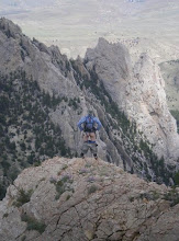
A brief human interlude on the landscape...
The Andean societies are famous for their ability to survive and thrive in harsh environments, and particularly famous for their asthetic sense of the mountains. The people of this region live very basic agriculture lifestyles, almost entirely dependent on the materials at hand for food and shelter. It is a classic example of human ingenuity in the face of challenging conditions.
Back to the description...
The human touch on this landscape is strong, yet complementary. The hills are completely saturated with Andinas, ancient agricultural terraces. The horizontal lines of the terraces contrast with the sloped lines of the sedimentary formations. They are not used anymore, partly because they were built when Lago Titicaca was still retreating from its Pleistocene high level and there was therefore much less arable land. At the foot of the hills can be found the modern day signs of humans, in the form of houses. Here the houses are almost entirely constructed of sandstone from the hills. The construction materials are extremely local, to the point that a hill that changes from red to purple sandstone is exactly matched in color by the houses at its base.
Yet just a few hundred meters from the base of the hill, there is not a stone to be found. This region is the old lake bed, and is still an active flood plain during the rainy season (January through March, approximately). The soil is relatively fertile, but extremely hard (because its the dry season now). Where it is not cultivated, it is covered in a sod-like layer of vegetation. This sod is either turned over (to oxigenate the soil and prepare it for cultivation) or literally cut out in bricks to make the houses, just like the settlers did on the Great Plains. So if you live at the foot of the hills, you have a stone house. If you live a few hundred meters away, you have a sod house.
This is a very arid environment during the dry season; everything is baked hard as a rock, and the color green is not existent. Yet this same floodplain is intermixed with lush swamps and wetlands, full of birds and exuburant algal growths (not necesarily a good thing from a biodiversity point of view). This is the point where I get overwhelmed and stop trying to categorize this landscape. And we haven´t even gotten to the huge lake, full of totora reeds (which of course are used to make floating islands and houses for the people who live ON the lake) and a threatened but formerly thriving fishery.
Enough writing, back to work, I`m off to conduct a survey of the Rio Ramis for the next four days with my new buddy Hector Flores, an Aymara who was born on an island in the lake. Check out Google Earth, try to trace the rivers from NW Lago Titicaca through towns like Taraco, Azongaro, San Anton and La Rinconada to get an idea of what we`re heading up.
To summarize what I`ve been trying to describe...this is a landscape completely unlike anything I`ve ever seen. I`m in awe of it.
Subscribe to:
Post Comments (Atom)


No comments:
Post a Comment